As competition heats up, roofing contractors have found new ways to build their businesses. Aerial maps are being used to generate leads, estimate with accuracy, quote and win business faster. Here we talk with Tony Agresta, VP of Marketing at Nearmap US, about the role aerial maps play in roofing, the accuracy of aerial mapping and the various forms of aerial photography available to roofers today.
What role do aerial maps play in helping roofers win more business?
Many roofing contractors have discovered new ways to build their businesses faster using advances in aerial maps that show current, high-resolution photography including how the roof has changed over time. Aerial photography has been used by a variety of businesses for the last five to 10 years to see details without the need to travel on site. Instant access to aerial photography allows roofers to be proactive. They can scan a massive amount of residential or commercial properties as they prospect for opportunities, and it also supports real-time responses to customer inquiries. Imagine a scenario where a customer calls, requests an estimate, and minutes later the roofing estimator has viewed the property online, measured the roof using photography that shows height and width, and generated a quote. In addition, roofers have uncovered ways to easily search and identify locations in need of repair as they direct their selling efforts in a highly targeted manner.
How are aerial maps captured and delivered to roofers? How accurate are they?
Many roofers rely on satellite images to analyze roofing detail. This approach suffers from two main problems: recency and resolution. A better approach leverages aerial imagery. Aerials are high-resolution photos captured by planes flying between 10,000 feet and 18,000 feet. Special camera systems capture hundreds of square miles per day per plane. The resolution for this type of imagery is known as 7-centimeter or 2.8-inch GSD, which is a technical way of saying that one pixel on the camera equates to less than three inches on the earth.
This resolution is much higher quality than satellite imagery and includes other advantages. A fleet of planes can capture hundreds of thousands of square miles annually. Through “continuous capture,” roofers gain access to current imagery updated multiple times per year. This allows them to see changes over time while also analyzing the roof without leaves on the trees. “Leaf-off” imagery plays an important role in accurate measurement while “leaf-on” imagery shows how close the trees are to the roof.
Once the photos are captured, they are run through a quality assurance process, stitched together into a seamless mosaic and streamed into the cloud. Roofers can access them remotely from a tablet or desktop. Anyone can search by address, city or location. They can pan and zoom, measure, view the roof from different angles, annotate the imagery and export it for use in proposals. Rather than travel to the site, all of this can be done in minutes.
What types of aerial maps are available today? What tips should roofers consider in building their businesses using this technology?
There are three main forms of “location content” that roofers should take advantage of today.
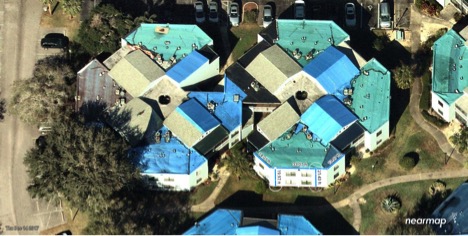
- Vertical or “top down” imagery: shows the details for each section of the roof looking straight down. Roofers can also inspect ground conditions, access to the roof, property features, road networks and proximity to other buildings and trees.
- “Oblique” imagery: captures the roof from an angled or birds-eye perspective. Roofers can visualize and measure height and width, calculate slope and see the property from all cardinal directions.
- “Panorama” imagery: allows roofers to visualize and analyze large areas and then zoom in on specific locations. Roofers typically scan neighborhoods or even sections of cities to identify areas to prospect.
Location content is evolving beyond these three forms. Immersive 3D visualizations will soon allow industry professionals to navigate around the property, inspecting details needed to access the roof. Digital surface models show elevation changes in the form of a heatmap using coded colors.
What are some tips to get started with aerial imagery?
- Use historical aerial maps in a side-by-side comparison to see how the roof has changed over time. Does the change analysis warrant a call to the prospect?
- For commercial roofers, identify the depth of parapet, key access points, HVAC equipment and other important roof features. Annotate the imagery providing direction for the roofing teams including placement of material, trouble spots and general measurements.
- View the property and roof from all cardinal directions. Measure height and width for each detailed roofing section. Save the imagery with all notes and measurements.
- Use the front of the property in your proposals and include plenty of imagery throughout your quotes. Your prospects will gain confidence from your detailed approach.
When time is of the essence, aerial mapping can play a vital role in customer service. Aerial photography provides instant access to roofing details that, in the past, would require on-site visits, climbing ladders and additional risk. Today, roofing companies can visualize the details from their offices. This leads to faster issue resolution, faster claims processing, better customer service and winning more roofing contracts.
To learn more about how imagery is helping business and government today, visit https://go.nearmap.com/. You can also request a free project review for an area of your choice.
Tony Agresta is VP of Marketing for Nearmap’s US division. He has more than 30 years of experience working closely with customers and industry experts to better understand how they use technology to accelerate their business.