By Tony Agresta, Vice President of Marketing, Nearmap US
Technology is changing the nature of emergency management, improving response times and arming first responders with precise information to make better choices. But improvements don’t always need to be high-tech or expensive. It can be as simple as having accurate, current, precise information about city infrastructure and other data points to inform responses.
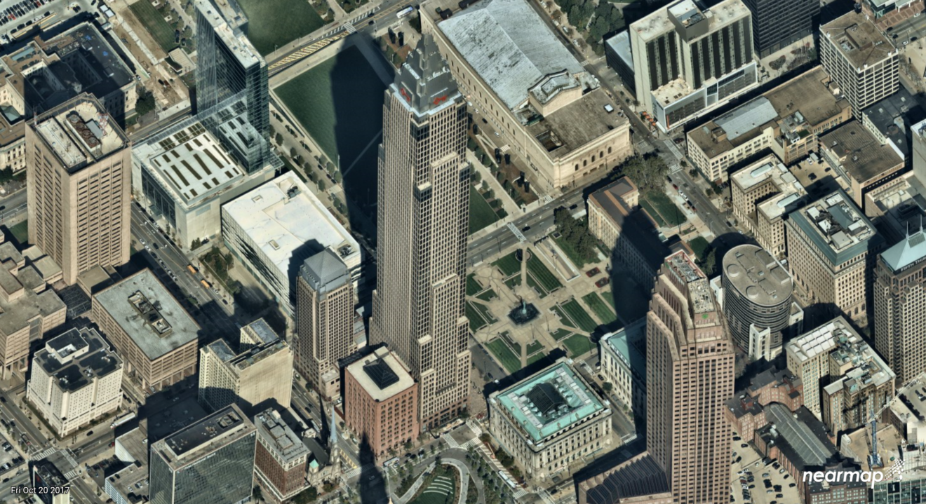
Emergency management teams are increasingly turning to high-resolution aerial maps to plan for potential events. Aerial imagery taken at various times of the year provide accurate street information, building locations and insights into densely populated areas. They can also give other important details such as building heights, lines of sight, traffic flows and other information about surroundings. For complex locations, aerial maps provide current detail that older, out-dated satellite imagery does not provide.
For example, many communities are developing urban centers with office, retail and residential spaces. In the event of a medical emergency, being able to guide first responders directly to the location in densely packed streets using the most up-to-date images showing streets, buildings and construction patterns can save lives. Additionally, for areas under construction, aerial maps show the truth on the ground, every new turn, landmark and obstacle. Instant access to aerial photography from your desktop or tablet can make all the difference.
Aerial mapping can be beneficial in many other scenarios:
- Situational awareness for special events: Special occasions like sporting events, concerts and street fairs often require street closures, the erection of temporary structures and changes to normal pedestrian and motor traffic flows. Aerial images captured before an event begins can be used to help police and other first responders account for these temporary changes and position resources to maximize their effectiveness.
- Crowd control: Images can be used to estimate crowds and provide information after events about where crowds gathered at specific times. First responders can annotate images to analyze what happened in different scenarios, where people moved and use that data to provide better service in the future. Barrier placement is improved with updated aerial imagery contributing to a well-orchestrated event.
- Scenario planning: For situations such as police raids, aerial images can help show obstacles, exit paths and other critical information about a building or location. This can be utilized in the planning phase to create more accurate scenarios making law enforcement better prepared for the task at hand.
Every second counts when responding to emergencies and having the ability to integrate these images into navigational systems, use them to measure distances and heights, as well as provide critical information on the ground can help first responders get their faster and safer. The public expects first responders to use the best available tools to provide these critical services.
To learn more about how imagery is helping business and government today, visit https://go.nearmap.com/. You can also request a free project review for an area of your choice and read about how aerial maps are improving emergency management
Tony Agresta is VP of Marketing for Nearmap’s US division. He has more than 30 years of experience working closely with customers, industry experts and governments on the use of technology to improve efficiency and save money.
